Orșova: A Danube Town Guide for the Iron Gates
Orșova sits on the Danube where the Almăj Mountains meet the Mehedinți Plateau, beside the Porțile de Fier reservoir. Here is how to place the town in a Danube trip.
On this page
Orșova is a small Danube town in south-west Romania, built where the Almăj Mountains meet the Mehedinți Plateau, on the shore of the Porțile de Fier reservoir. Treat it as a river town and a staging point rather than a sight-packed stop, and plan your day around the water and the valley behind it. This guide covers where the town sits, how to read its layout, how long it needs and how it slots into a longer Danube trip.
Approach Orșova by road or rail along the Danube corridor and the river is the first thing you see; the town spreads back from the bank towards the hills. Nothing in the way of boat timetables or ticket desks is fixed here, so settle those with the boat companies or the tourist office once you arrive rather than building a schedule around them.
What Orșova is and where it sits on the Danube
Orșova lies on the Danube in the south-west of Romania, where the Almăj Mountains meet the Mehedinți Plateau, on the bank of the Porțile de Fier reservoir. That junction is the key to the place: hills close in on one side, the plateau opens on the other, and the river carries on along the Iron Gates corridor. Picture a town pinched between upland and water rather than a broad open plain.
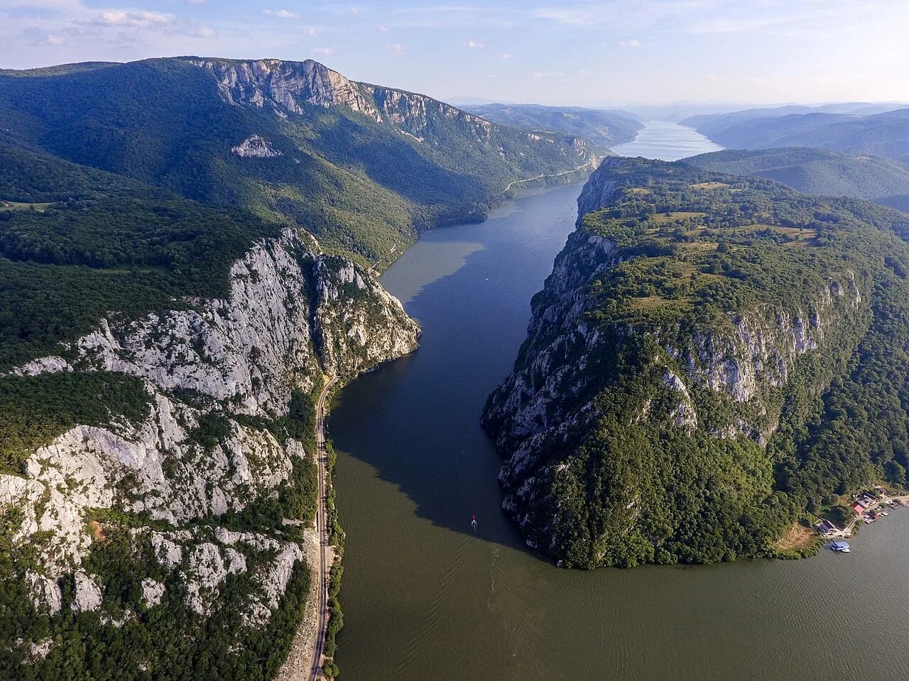
The town also sits on the Porțile de Fier reservoir, the impounded stretch of the Danube along the Iron Gates. That means the river here reads as a wide lake rather than a fast narrow channel, which changes how the waterfront looks and how the valley behind it drains. If you are coming from the gorges upstream, expect the water to open out noticeably on the approach.
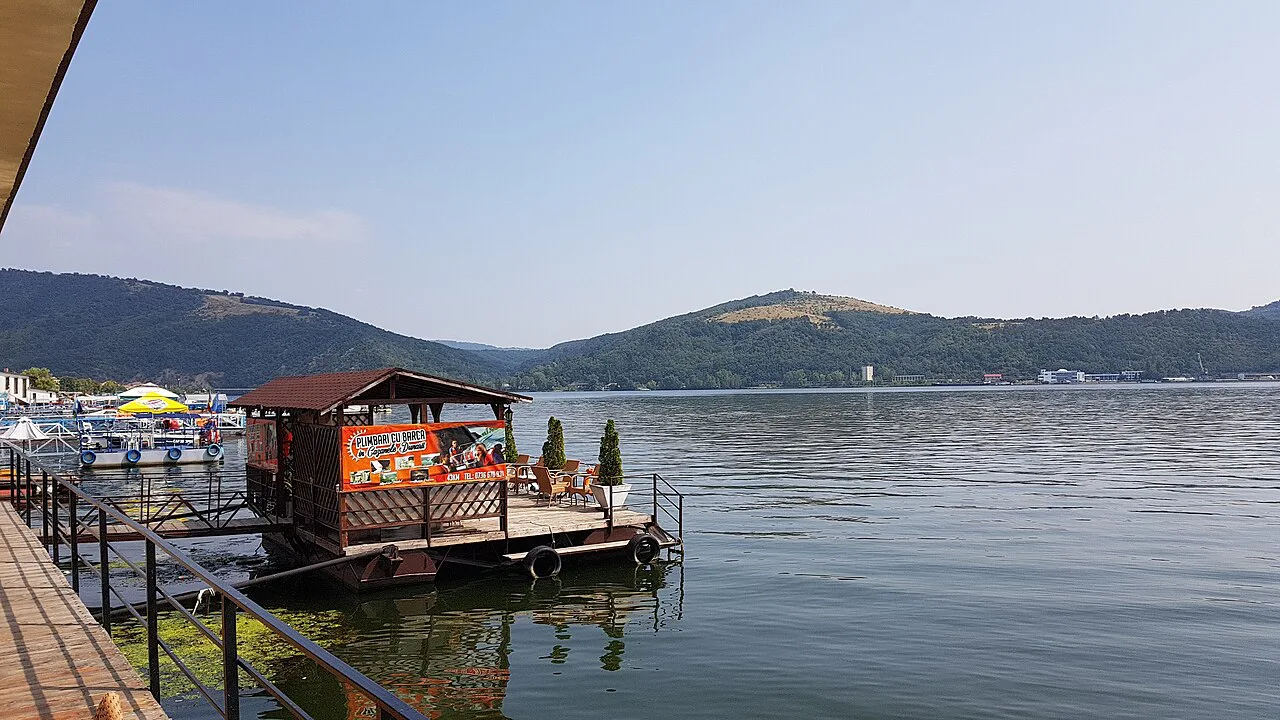
Where the town lies between the Almăj Mountains and the Mehedinți Plateau
The Almăj Mountains belong to the Banat side of the range, while the Mehedinți Plateau stretches into Oltenia, so Orșova sits roughly on the seam between two historic regions. For a traveller this matters mainly for road planning: approaches from the north and east come through hill country, while routes from the west follow the Banat bank of the Danube. Check your route on a proper Romanian road map before setting off, because the terrain dictates the roads rather than the other way round.
Because the town is hemmed in by upland, the built-up area is compact and the surrounding countryside rises quickly once you leave the main streets. Allow for slower driving on the minor roads that climb away from the river, and treat distances on the map as optimistic compared with the time they actually take. A paper or offline map is worth having, since signal in the folds of the hills is not something to rely on.
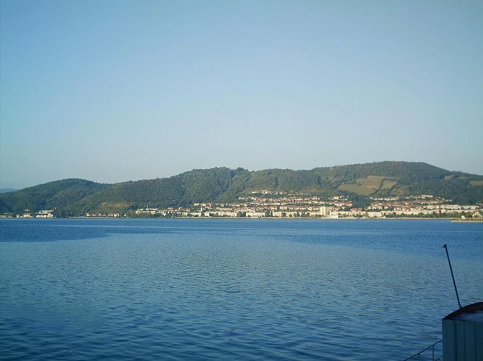
Orșova on the Porțile de Fier (Iron Gates) reservoir
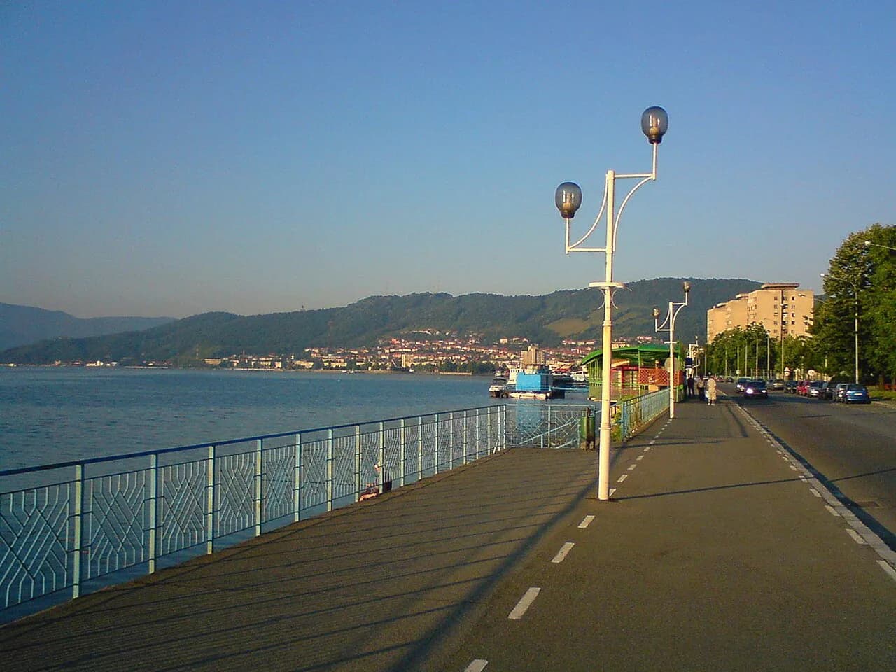
The Porțile de Fier reservoir is the stretch of the Danube held back by the Iron Gates dam scheme, and Orșova faces it directly. The result is a wide, slow-moving body of water with a shoreline that shifts with the reservoir level, so the town's relationship with the river is more lakeside than riverbank. Plan on the waterfront being the natural place to start and end a walk.
The Cerna River comes down through this part of the country, and its valley gives Orșova a second axis away from the water. If you want a short leg-stretch, following the Cerna valley inland is the obvious direction; photographs of the area show the river, an old observation tower and the wooded foothills of the Carpathians. None of that comes with published access details, so check locally what is open before you commit a half-day to it.
Orienting yourself: the riverfront, the Cerna valley and the town map
Read Orșova as two lines: the Danube frontage, where the town meets the reservoir, and the Cerna valley running inland from it. Start on the waterfront, get your bearings on the water, then work back into the streets behind it. The town is small enough that you will not need public transport within the centre.
The published town map is the reliable reference for street names and the shape of the centre. Load it before you travel, mark the waterfront and the Cerna corridor, and use it to decide where to park; the compact centre means you will do most of your moving on foot once the car is down.
How long Orșova needs in a Danube itinerary
Give Orșova half a day to a full day. Half a day covers the waterfront, a walk into the centre and a drive up the Cerna valley; a full day lets you add a river experience on the reservoir without rushing the rest. Anything longer starts to depend on activities the town's own sources do not spell out, so decide on the ground.
Orșova works best as a night's stop on a Danube run rather than a destination in its own right. The setting does the work: you arrive, walk the bank, eat, sleep and move on towards the gorges or back east. Build the itinerary around the river road and keep the town as a hinge rather than a highlight.
Getting there and onward along the river
Orșova is reached by road or by rail along the Danube corridor; the town's position on the reservoir makes it a natural break between the eastern Danube towns and the Iron Gates proper. Rail and road both follow the river, which keeps the journey scenic but also means delays on the corridor affect everything. Check current timetables with CFR Călători for trains and the local bus companies before you travel, since they change with the season.
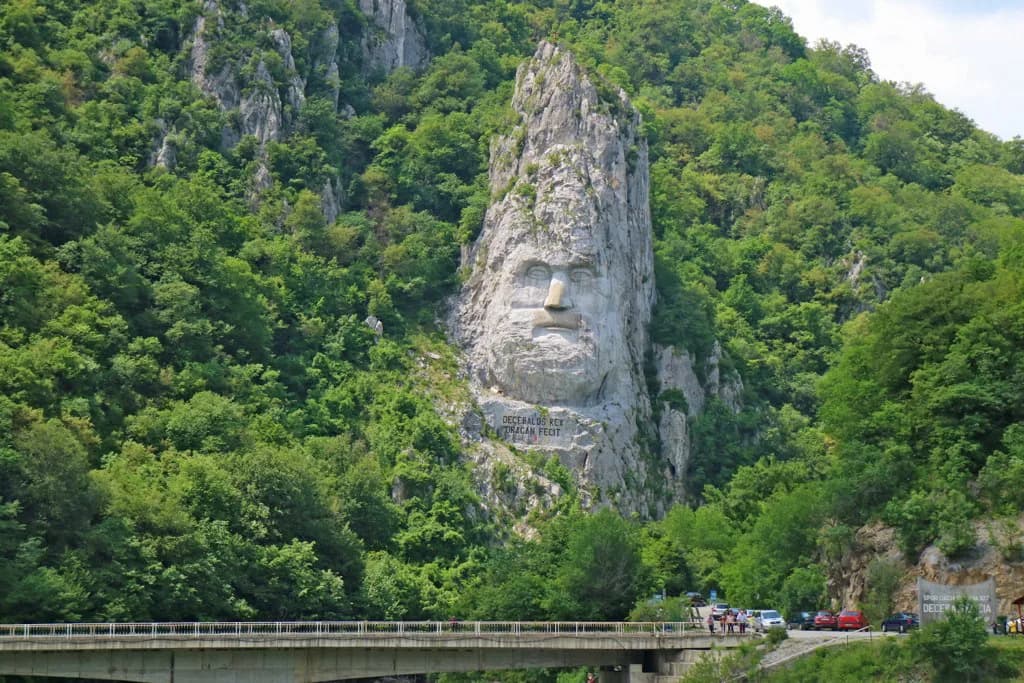
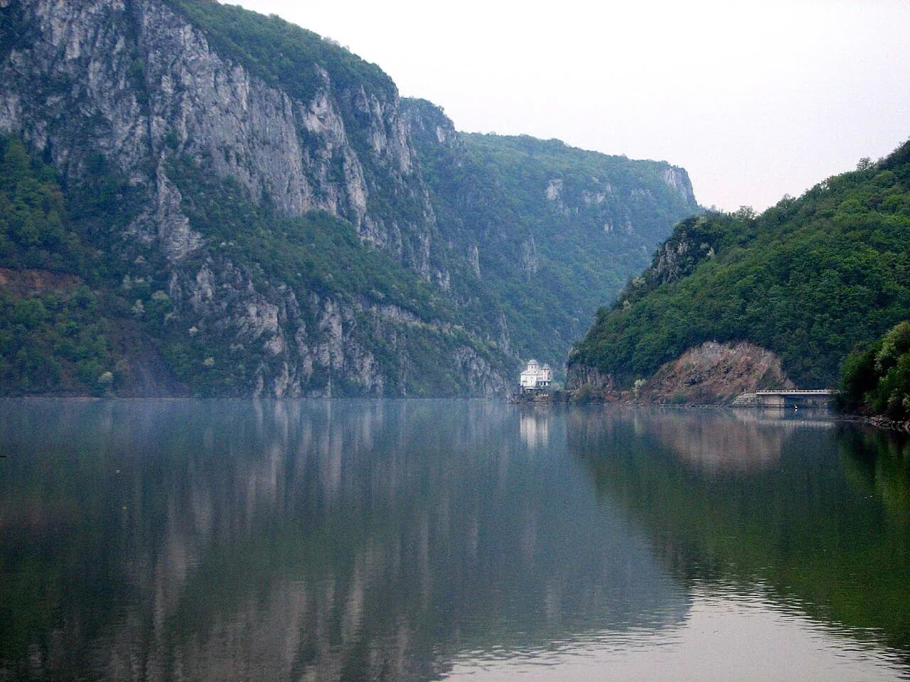
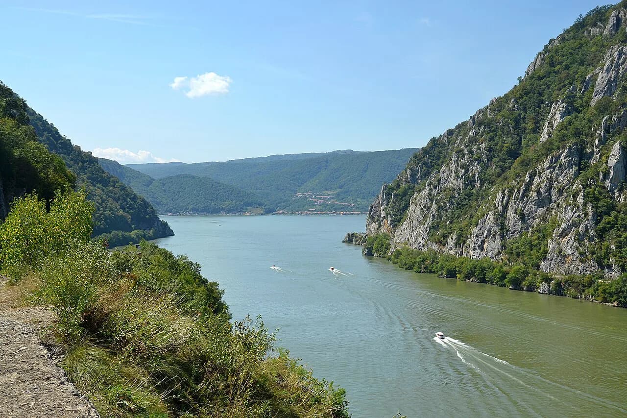
Onward from Orșova, the Danube narrows into the Cazanele Dunării, the gorge section of the Iron Gates, where the river squeezes between cliffs. Boats run from the riverside settlements into that stretch, and the Decebalus Rock Sculpture at the Iron Gates is the landmark most people come to see from the water. Book through a local boat company on the day and confirm departure points locally, because the reservoir level and the season shape what runs.
If you are driving the corridor, the Cazanele Mici section is the tightest and most dramatic part of the run and rewards a slow pass with a stop at one of the laybys. Allow extra time for photo stops and for the occasional convoy behind a lorry on the riverside road. Fuel up before the gorge stretch, where services thin out.
Where Orșova fits on a Danube trip in Romania
Orșova is the western hinge of a Romanian Danube trip: come from Drobeta-Turnu Severin in the east, break here, then carry on into the Iron Gates gorge or turn north into the Banat hills. It pairs naturally with the gorge boat trips and with the riverside villages, and it makes a sensible overnight before or after the narrowest water. A Danube itinerary that skips it loses the transition between open river and gorge.
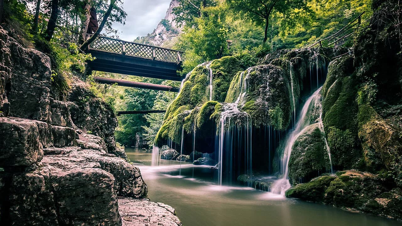
Inland from the Danube, the Bigăr Waterfall sits in the same corner of the country and is often combined with a river day, though access and conditions vary. Treat it as an add-on rather than the reason for the trip, and check the route and any entry arrangements before you divert. The waterfall makes most sense if you already have a car and a spare afternoon.
For the wider context of the gorge, the reservoir and the settlements along it, the Iron Gates pages here cover the geography and the boat options in more detail. Use them to decide which bank you travel and where you sleep, then keep Orșova as the practical stop in the middle.
Should Orșova be on your Danube route?
Yes, if your route already follows the Danube and you want a compact, scenic stop with the reservoir in front of you and the Cerna valley behind. No, if you are looking for a town of museums and set-piece sights; Orșova is a place to break a journey, not to fill a week. Decide by your route rather than by a checklist.
Confirm train and bus times with the carriers, check boat departures for the gorge locally, and carry an offline map for the hill roads. With those three sorted, Orșova does its job as the hinge between the open Danube and the Iron Gates.
Explore more Iron Gates guides
Frequently Asked Questions
Do you need a car to see Orșova?
No for the town itself: the centre and the waterfront are compact and walkable once you arrive. A car helps for the Cerna valley and for continuing along the Danube towards the gorge, where riverside roads and sparse services make driving the practical option.
How does Orșova relate to the Iron Gates?
Orșova stands on the Porțile de Fier reservoir, the impounded stretch of the Danube behind the Iron Gates dam, where the Almăj Mountains meet the Mehedinți Plateau. The gorge section, the Cazanele Dunării, lies along the river from the town and is usually seen from the water or from the riverside road.
Sources
Useful notes for your next trip
Optional updates to our guides.
You might also like
Continue reading
More guides you'll find useful