Măcin Mountains: Romania's Oldest Mountains and How to Visit
Măcin Mountains National Park in north-west Dobrogea holds Romania's oldest rock, steppe slopes and Tauric beech at Beech Valley.
On this page
The Măcin Mountains are Romania's oldest mountains, a low, dry range in north-west Dobrogea where Tutuiatu Peak reaches 467 m. The national park protects only the central and highest part of the range, so the visitor sees a compact block of ridge and steppe rather than a full mountain massif. This guide sets out where the range sits, what the rock and vegetation look like, how to reach the entrances by road and what the climate asks of you.
Where the Măcin Mountains are
The range lies in the south-east of Romania, in the north-west of Dobrogea and inside Tulcea County, between the Danube Valley, the Luncăvița Valley and the Cerna-Horia saddle. That position explains the dry character of the place: the ridges rise out of a lowland corridor rather than sitting in a wet upland. If you are working out how the region fits together, the wider Dobruja guide covers the coast, the delta edge and the inland towns in one place.
The mountain range and the national park are not the same thing. The park occupies the central and highest area of the Măcin Mountains, which the park service presents as the oldest geological formation in the country, with ridge lines running roughly north-west to south-east. Plan your day around the park boundaries rather than the whole range, and treat the surrounding land as approach country rather than protected ground.
Why they are called Romania's oldest mountains
The rock formed during the Hercynian orogeny, and the park describes the range as a remnant of Hercynian-Cimmerian mountain building. That origin is why the landscape reads as worn-down and low rather than alpine, with the highest ground falling well short of Carpathian heights. The oldest-mountains claim is a geological point about the age of the formation, not a statement about scale.
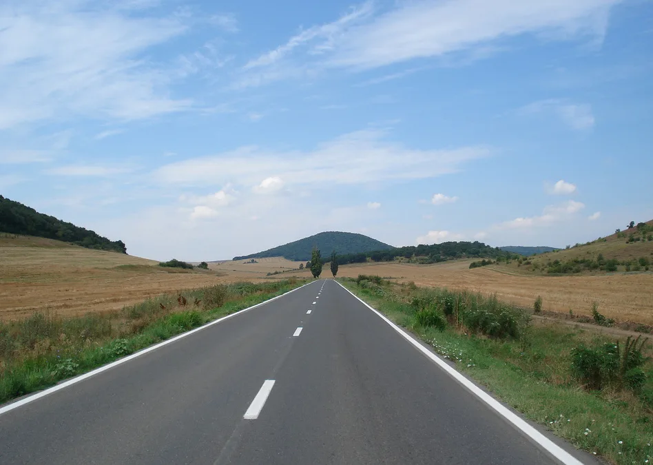
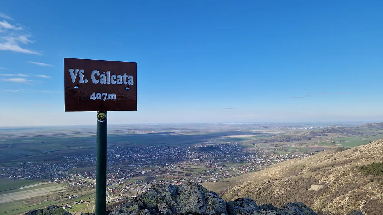
What you see on the ground follows from that age and from the arid climate. Ridges have been reduced, slopes are often rocky and steep, and scree covers parts of the western frame of the Măcin Heights. Expect a walk through exposed, broken terrain with wide views, not a forest tunnel.
The lie of the land: ridges from 7 m to 467 m
The park's altitude runs from about 7 m up to 467 m at Tutuiatu Peak, with vegetation changing as you climb. Steppe landscapes sit on the lower slopes and give way to forests of oak, flowering ash, hornbeam and downy oak, then to bushes on the peaks and cliffs, and finally to steppe-like alpine meadows on the tops. Walking here is largely about reading those bands rather than ticking off summits.
The park's presentation of its own landscape describes steppe and Balkan-influenced forest of a kind more often associated with southern Europe, and it sets the Pricopan Heights apart as the most alpine-looking ground in the park. That contrast is the reason to walk more than one ridge if you have the time.
Beech Valley Natural Reservation and the Tauric beech
Beech Valley Natural Reservation is the park's known reserve, and it is the one name worth remembering before you arrive. It is distinguished by Tauric beech, which shows intermediate characters between native beech, Oriental beech and coppice flora, and which occurs in Dobrogea in this form alone, comparable to Crimean beech forests. For a visitor, that means a stand of trees worth slowing down for rather than a waypoint on the way to a summit.
Treat Beech Valley as a target to locate locally rather than a fixed circuit. Ask about the current approach before setting out and keep to paths that are already in use, since the vegetation here is the reason for the protection.
The climate you are walking in
Average annual temperatures sit at 10–11°C and average precipitation stays below 500 mm, which makes these the country's driest mountains on the park's own figures. Summers are very hot and dry, autumns long and dry, and winters freezing with very little snow. These are climate averages rather than a forecast, so treat them as the pattern to pack for, not a guarantee for your dates.
Winds blow frequently from the north and north-east, and the continental character is strongest on the southern, steppe side of the protected area. On the day, carry more water than a comparable walk in the Carpathians suggests and expect little shade on the exposed sections.
Getting there by road
Access is by road, and the three approaches are distinct. From the west and south-west, enter via DN22D between Măcin and Horia. From the north, the E87 links Horia and Luncăvița. From the Horia–Luncăvița county road you reach the east and north-east of the park.
That means the practical decision is which side of the park you want to start from, not which single gateway to find. The western DN22D approach between Măcin and Horia serves the Măcin and Pricopan side of the park, while the Horia–Luncăvița county road reaches the east and north-east. Check road conditions locally before committing to a route.
The Pricopan Heights and Suluc Peak
The Pricopan Heights are the park's most distinctive ground, with steep and rocky ridges that the park describes as alpine in relief. Suluc Peak reaches about 370 m, lower than Tutuiatu but sharper in profile. If you want the dramatic end of the Măcin landscape in a short visit, this is where to head.
Active rock disintegration has left many erosion witnesses with ring-like shapes across these heights, and the scenery changes quickly over short distances. The trade-off is footing: rocky, uneven ground rewards boots and slows progress, so plan a shorter day here than the modest altitudes suggest.
Reading the landscape: rock types and erosion witnesses
The park lists granitic gneiss in the south and east, crystalline limestone in the south-east, and metamorphic and igneous rocks in the north, with yellow soil deposits on the plateaux. Knowing this explains why the ridges look the way they do: hard rock stands proud while softer ground wears back. Carapelit formations of conglomerates, sandstones and detrital shale add bands of softer, crumbly material.
The ring-shaped erosion witnesses are the feature to watch for on the heights, where rock has weathered into circular forms around a resistant core. They are a landscape detail rather than a marked attraction, so look for them on the exposed ridges rather than asking for a signposted stop.
Temporary waterfalls after spring rain
The rivers here are rainwater-fed, short and variable, and most run only temporarily. In wet periods, especially in spring, small waterfalls form on the rocky valleys. That makes spring the moment to see them and the rest of the year the moment to expect dry beds.
Plan around recent rain rather than around a fixed date, since flow depends on what has fallen in the preceding days. Even then, the falls are a bonus on a walk rather than a destination in their own right.
Where the park sits in a Dobrogea trip
The Măcin Mountains work as an inland day from Constanța or Tulcea rather than as a stop on the coast. The coast itself holds the Greek ruins at Histria on Lake Sinoe, which suit a separate half-day, while the inland Roman monument at Tropaeum Traiani and the fortress at Enisala fill other days in the same region.
A realistic day involves driving to one of the road approaches, walking a ridge or two, and returning. The park publishes no opening hours or ticket prices to plan around. Check current access and any park rules with the national park administration before you go, and keep the walk short enough to drive back in daylight.
Is the Măcin detour worth your day?
Take the detour if you want dry, open, geologically old ground and can accept low altitudes and rough footing. Skip it if you are after a forested Carpathian day or a signposted attraction with facilities.
Build the day around one approach road, one ridge group and Beech Valley, and check access and conditions before leaving. For the rest of the region, start from the Dobruja guide and link the mountains to the coast and the Danube edge.
Explore more Constanta guides
Frequently Asked Questions
Do you need a car to visit the Măcin Mountains?
Road access is the practical way in: DN22D between Măcin and Horia, the E87 between Horia and Luncăvița, and the Horia–Luncăvița county road for the eastern side of the park. Check current road conditions before setting out.
How high are the Măcin Mountains?
The park runs from about 7 m to 467 m at Tutuiatu Peak, with Suluc Peak in the Pricopan Heights reaching roughly 370 m. The heights are modest but the ground is often rocky and steep.
Sources
Useful notes for your next trip
Optional updates to our guides.
You might also like

Continue reading
More guides you'll find useful