Transfăgărășan: Driving Romania's Făgăraș Mountain Road
The Transfăgărășan climbs the Făgăraș mountains between Cârțișoara and Curtea de Argeș. Here are its stops, opening months, driving times and crowds.
On this page
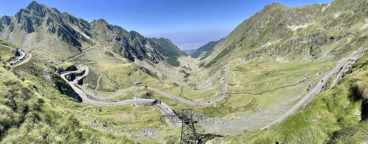
The Transfăgărășan is Romania's signature mountain drive: DN 7C, running between Cârțișoara near Sibiu and Curtea de Argeș, climbing to 2,042 m at Bâlea Lake. Sources give the length as either 71 miles (114 km) or 90 km. Allow about three hours to drive it end to end without stopping; a full day if you want the lake, the waterfall, the dam and Poienari Fortress. This guide covers the route, its stops, the weather-dependent opening window, and how to weigh self-drive against a tour. If you are planning a mountain-road day in Romania, our Brasov Attractions guide shows which sights to book and which are free.
Treat the drive as a plan with decisions, not a straight run. Which end you start from changes what you see first, and the time you set aside per stop decides whether you reach Bâlea Lake in cloud or in the clearer middle hours.
What the Transfăgărășan is and where it runs
The road is DN 7C, linking Transylvania in the centre of the country with Walachia in the south through the Făgăraș Mountains. It begins at Curtea de Argeș, 95 miles north-west of Bucharest, and ends at Cârțișoara, about 30 miles east of Sibiu.
Sibiu sits about 30 miles west of the Cârțișoara end and Brașov about 65 miles east of it, with Pitești 23 miles south of Curtea de Argeș. That makes both Sibiu and Brașov workable bases for the northern approach, while Bucharest and Pitești feed the southern one. If Brașov is your base, our Brasov Attractions guide covers which sights in the city are worth booking and which are free.
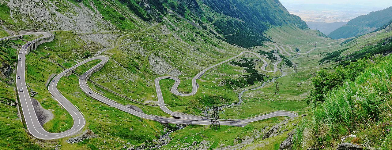
The road was built for military purposes at the initiative of Nicolae Ceaușescu, Romania's last communist leader, and crosses the range through five tunnels and 27 viaducts. Climbing from 1,630 feet at Cârțișoara to almost 6,700 feet at Bâlea Lake, it stays below the tree line until roughly 5,000 feet, then opens out.
How long the drive takes with and without stops
A clear through-run takes around three hours; a leisurely version with photo stops can fill a whole day. Photo opportunities come thickly along the route, so decide in advance which stops are non-negotiable and which you will skip.
One guide describes the road as 90 km with such a density of stops that a guided tour from Brașov runs eight hours. Whether the distance is given as 114 km or 90 km, the point for planning is the same: the clock goes on stops, not on tarmac. If you are extending the trip with a city day, our Brasov Attractions guide shows which sights to book and which are free.
The traveller error this route punishes is under-budgeting time. Build in slack from the start, because once you are past the tree line the stops come one after another and turning back is not practical.
When the road is open end to end
The scheduled end-to-end season runs from 1 July to 31 October, weather permitting. Early reopening happens when the weather is good, snow has been cleared and there is no avalanche risk, and the road authority announces that 24 to 48 hours in advance.
The actual dates move year to year. In 2019 the road reopened on 29 June and closed on 4 November; in 2023 it reopened on 21 June and closed on 6 November. Treat the pattern as the guide and the specific date as provisional.
The road authority can also reopen or close sooner than scheduled at short notice if conditions allow or demand it. Check the current road status before you set out rather than relying on a date you read months earlier.
Which direction to drive
From Cârțișoara, near Sibiu, you climb first through forested valleys with glimpses of jagged peaks, reaching Bâlea Lake before the southern descents. From Curtea de Argeș, you meet the dam and Poienari earlier and arrive at the high lake later in the day.
If you are coming from Bucharest, start at Curtea de Argeș and save the Bâlea Lake section for the middle of the day. It is the reverse of the usual north-to-south plan, but it puts the high point in daylight rather than at either end of a long day. If you are basing yourself in the region before the drive, our Brasov Attractions guide covers which sights in Brașov are worth booking and which are free.
After Bâlea Lake on the southern descent you pass the most popular attractions: Poienari Fortress, the castle linked to Vlad the Impaler, then Lake Vidraru and its dam. Plan that stretch deliberately or you will pass it at speed.
Bâlea Lake: the high point
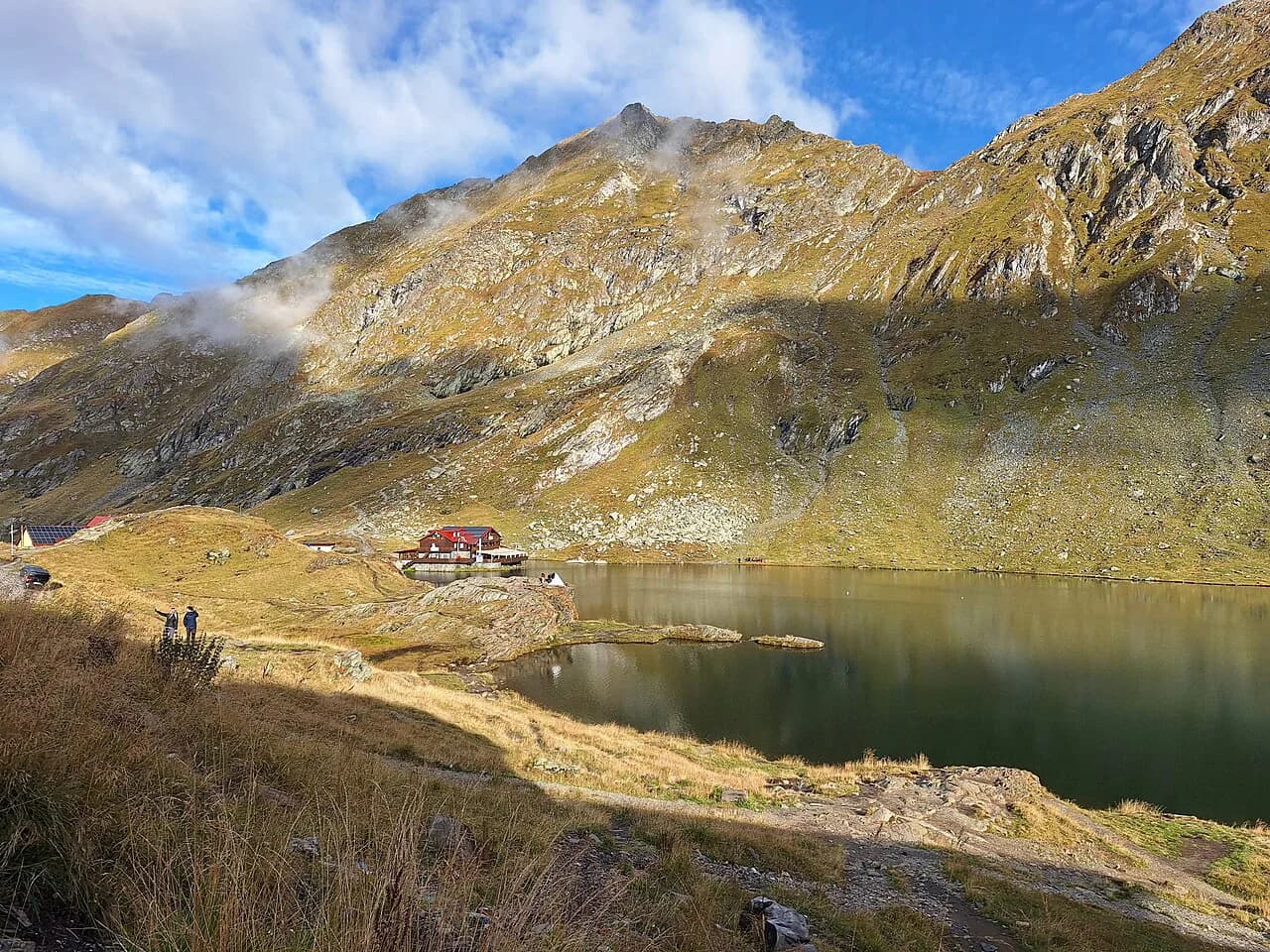
Bâlea Lake sits at the top of the highway, a glacial lake with clear water even on foggy afternoons. You can walk into the mountains, buy local artisan products, or simply stand at the water for a photograph in the cold.
At 2,042 m, the lake is the highest point of the drive and the place where weather changes fastest. Fog is common enough that the source treats it as part of the experience, so keep a warm layer accessible rather than packed at the bottom of the boot.
The lake has the highest setting on the drive and the shortest walks; the point of stopping here is the view and a short wander. Give it the longest single slot in your day if you have budgeted one.
This is where the altitude and the cloud make the difference to the whole drive. If the lake is clear, stay; if it is not, the descent has plenty to offer further down.
Bâlea waterfall and the northern descent
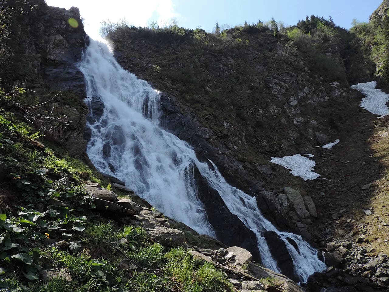
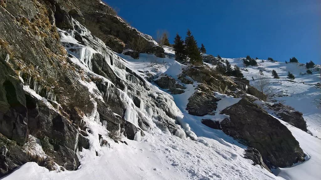
Coming down towards Cârțișoara, the Bâlea Waterfall and the Bâlea Cascadă chalet area are the natural pause between the high lake and the valley. It is a short detour from the road itself and a good place to stretch before the last forested kilometres.
The northern side is the gentler half of the drive in terms of views: forest closes in, the road drops steadily, and the peaks recede. Keep that in mind when you are deciding how much time to spend at the top.
The Capra waterfall area is another stop on the mountain, best treated as a short break rather than a hike unless you have allowed the time. Each extra stop on this stretch costs you the same twenty or thirty minutes.
Vidraru dam and lake on the southern side
Descending from Bâlea Lake, the southern route passes Lake Vidraru and crosses the dam, one of the road's most photographed features. The lake fills the valley below the dam and the road runs along its edge.
Drivers who underestimate the time on the mountain end up skipping the dam and the fortress, so decide before you set off whether these two southern stops are in. If they are, you need the full day rather than three hours.
Poienari Fortress: the climb and the Vlad III connection
Poienari Fortress, on the southern side of the road, is the castle that served as Vlad the Impaler's residence. An uphill climb leads from the road to the ruins, so it is a stop to decide on before setting off rather than at the car park.
The walk up takes real effort and time, and it comes on the same day as the drive. If you are doing the road as a three-hour run, Poienari probably does not fit; if you have a full day, build it in deliberately.
The Vlad the Impaler association is the historical figure, not Bram Stoker's fictional count. The castle's place in the road itinerary is as a ruined fortress above the Argeș valley, not as a Dracula attraction.
Curtea de Argeș at the southern end
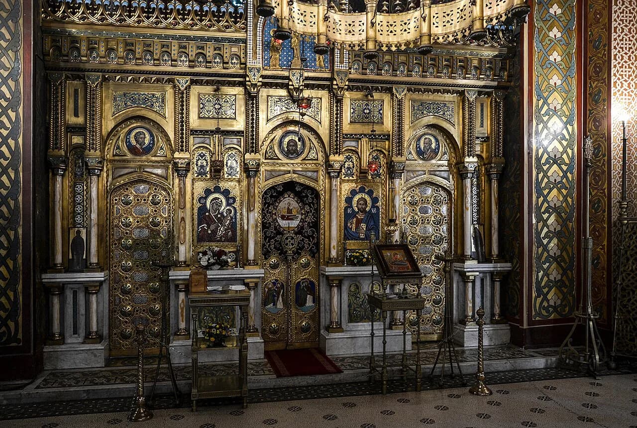
At the southern end, Curtea de Argeș is a town in its own right as well as the gateway to the road from the Bucharest side. Its monastery is a fine example of Byzantine Orthodox church architecture, commissioned in 1514 by Prince Neagoe Basarab and completed in 1517.
The monastery has been restored and its interior carries frescoes by painters including the French artists Emile-Frédéric Nicolle and Charles Paul Renouard and the Romanian Nicolae Constantinescu. If you start the drive here, the monastery is the natural first stop while you are still on flat ground.
Plainly, the southern approach gives you a monastery and a fortress before the mountains; the northern gives you the lake first. Pick the order that suits your base, then plan the stops around it.
Driving conditions: hairpins, gradient and tunnels
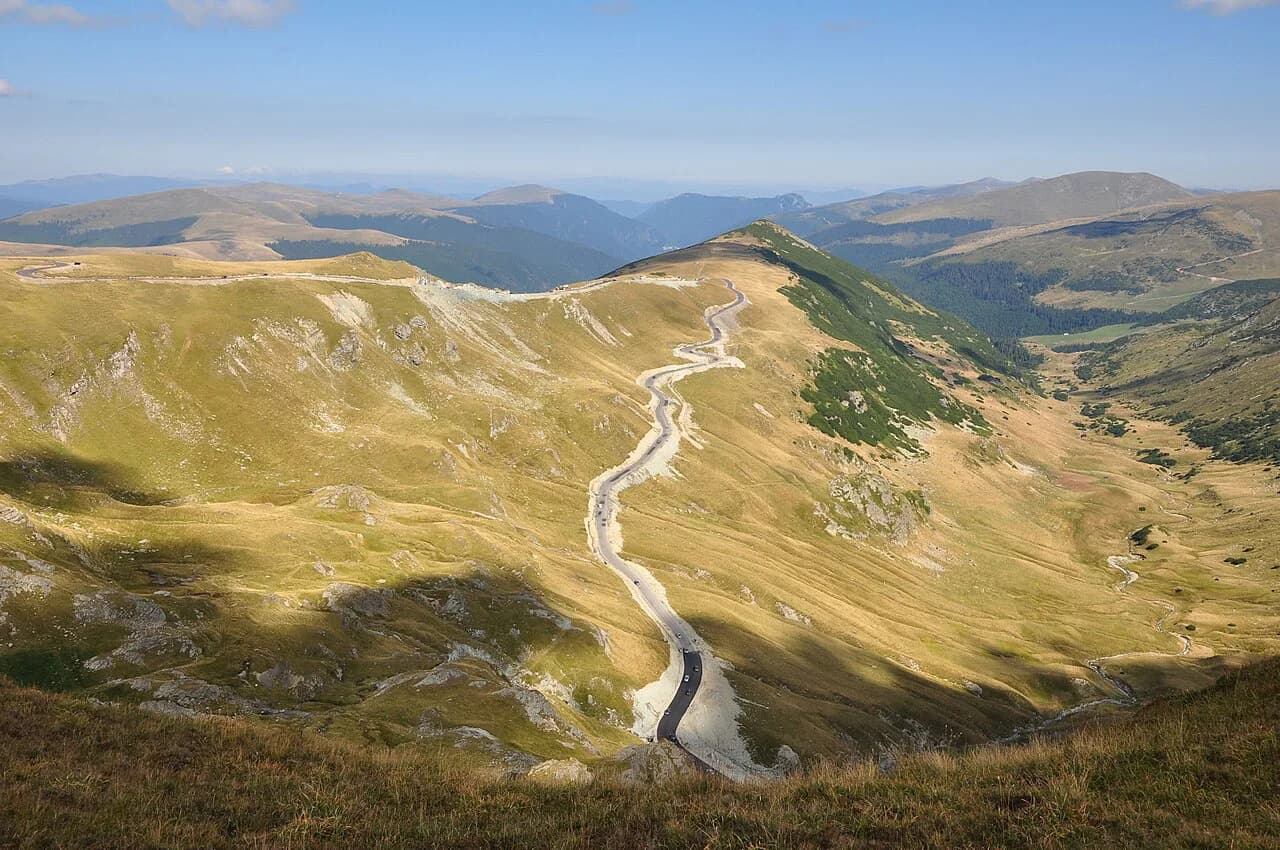
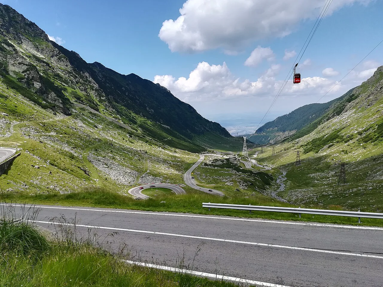
The road was engineered for heavy military vehicles, so the gradient never becomes too steep; the hairpin bends and switchbacks do the climbing instead. The ascent feels manageable even in a modest car, but the number of curves makes it slow.
Tunnels vary in clearance, and a road sign shows a height of 3.6 m at one underpass. Visitors have reported a 3.9 m high vehicle passing all tunnels and underpasses without trouble, so the sign looks out of date; if you drive a high van or carry a roof box, treat 3.6 m as the cautious planning figure and check the signs on the day.
For a comparison with the other great Romanian mountain road, the Transalpina, note that the two have different characters and different seasons. The Făgăraș route is the one that rewards an early start and a full day.
Traffic: holidays and weekends versus quiet weekdays
The road gets crowded during the holiday months of July and August and at weekends. In the off-season and on weekdays, the traffic thins considerably.
The practical move is to reverse the crowd pattern: aim for a weekday in June or the first week of July, or the second half of September. On a peak August Saturday, the hairpins become a queue and the three-hour run stops being realistic.
Flexibility on the day helps too. If the pass looks busy, an early arrival at Bâlea Lake before the coaches build up gets you the parking space and the clearer view.
Self-drive or a guided tour from Bucharest or Brașov
Self-drive gives you freedom over stops, arrival at Bâlea Lake and detours. On the other hand, you handle the parking, the hairpins and the hours of concentration. Guided tours from Bucharest or Brașov trade that freedom for a fixed itinerary with no driving stress; one tour from Brașov that includes Bâlea Lake takes eight hours. If you would rather build a sightseeing day of your own before or after the drive, our Brasov Attractions guide helps you choose what is worth booking.
Pick the tour if you want the mountain without the wheel and accept that the schedule is set; pick self-drive if Poienari, the dam and the lake need to fit your own timing. Both get to the same road.
The honest trade-off is time versus flexibility. There is no wrong answer, only the question of whether you would rather hand the hairpins to a guide or keep the day your own.
Where the road fits into a Brașov or Sibiu trip
From Brașov, the road is a long day out: 65 miles to the Cârțișoara end, then the crossing. Finishing the day in Sibiu or Curtea de Argeș makes the drive's end easier than returning the same evening.
From Sibiu, the northern approach is short enough that you can leave in the morning and still have daylight on the mountain. From Bucharest, the southern approach via Curtea de Argeș is the natural route to the dam and the fortress. If you are weighing city bases instead, our Brasov Attractions guide shows which sights to book and which are free.
Keep the road day as a single-purpose day rather than tagging it onto another drive. Stacking a second long outing on top of the Transfăgărășan is how you end up rushing the lake.
Wildlife on the road
The Făgăraș Mountains carry brown bears and other wildlife, so the drive passes through populated country rather than an empty landscape. Keep food inside the car, do not stop to feed or photograph animals from the road, and read up on local guidance before you go.
The reaction to a sighting is the same either way: slow down, give the animal space and drive on. A stop on the verge creates a second hazard behind you.
Should you drive the Transfăgărășan or take a tour?
Drive it yourself if you want the stops in your own order and can commit a full day in the quieter weeks. Take a tour if you would rather not handle the hairpins and are content with a fixed itinerary.
Either way, check the road status before you go, keep the plan flexible, and put Bâlea Lake in the middle of the day rather than at the margins.
Explore more Transfagarasan guides
Frequently Asked Questions
What is the famous road in Romania?
The Transfăgărășan, DN 7C, is the road most visitors mean: it crosses the Făgăraș Mountains and reaches 2,042 m at Bâlea Lake. The Transalpina is the other well-known mountain road, with a separate route and season.
Is the Transfăgărășan closed?
The end-to-end season is scheduled from 1 July to 31 October, weather permitting, with early reopening or closure announced at short notice. Check the current road status with the road authority before setting out.
Sources
Useful notes for your next trip
Optional updates to our guides.
You might also like
Continue reading
More guides you'll find useful