Retezat National Park: Glacial Lakes, Access and Park Rules
Retezat National Park holds around 80 glacial lakes and 50 peaks above 2,000 metres. Here is how to reach the park entrances and what to expect inside.
On this page
Retezat National Park is a walker's park, not a drive-up viewpoint: you choose a northern or southern entrance, park in a village and set off on foot. This guide sets out what the park holds, how each entrance is reached by car, bus and rail, and which nearby sights fit around a visit.
The park sits in the Southern Carpathians in Hunedoara county and covers around 94,000 acres, with more than 50 peaks above 2,000 metres and roughly 80 glacial lakes. Its network of marked paths sits within the wider range covered in our guide to the Carpathian Mountains, which is useful if you are comparing several upland areas before booking.
What Retezat National Park is and where it sits
Retezat lies in the Southern Carpathians, in Hunedoara county, and was established in 1935 as Romania's first national park. It is classed as a category II IUCN national park and contains more than sixty peaks, so the terrain is high and continuous rather than a single mountain.
The northern edge opens from villages near Hațeg, while the southern edge is reached from the Petroșani and Lupeni side. That split matters more than any single sight: it decides your drive, your base and which lakes you can reasonably walk to in a day.
The glacial lakes and high peaks
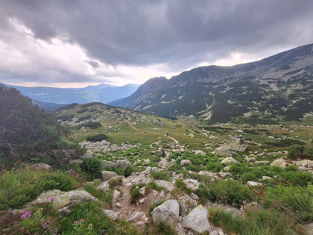
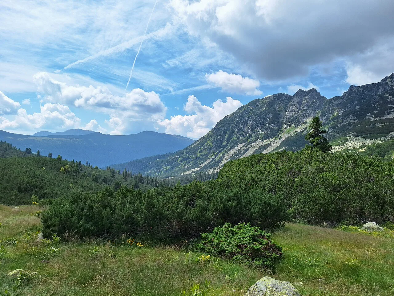
The park is best known for its glacial lakes, around 80 of them, including Bucura at about 8.8 hectares and Zănoaga, which reaches a maximum depth of roughly 28 metres. Above them, 50-odd summits pass the 2,000-metre mark, which is why the walking is sustained rather than gentle.
Forest line sits around 1,850 metres, with spruce holding on in the harshest spots, and more than a quarter of the range lies above about 1,755 metres where ice-scoured valleys end in lakes and waterfalls. Read that as a warning about exposure and changeable conditions rather than a set of figures to plan a route around.
Wildlife and plants you may come across
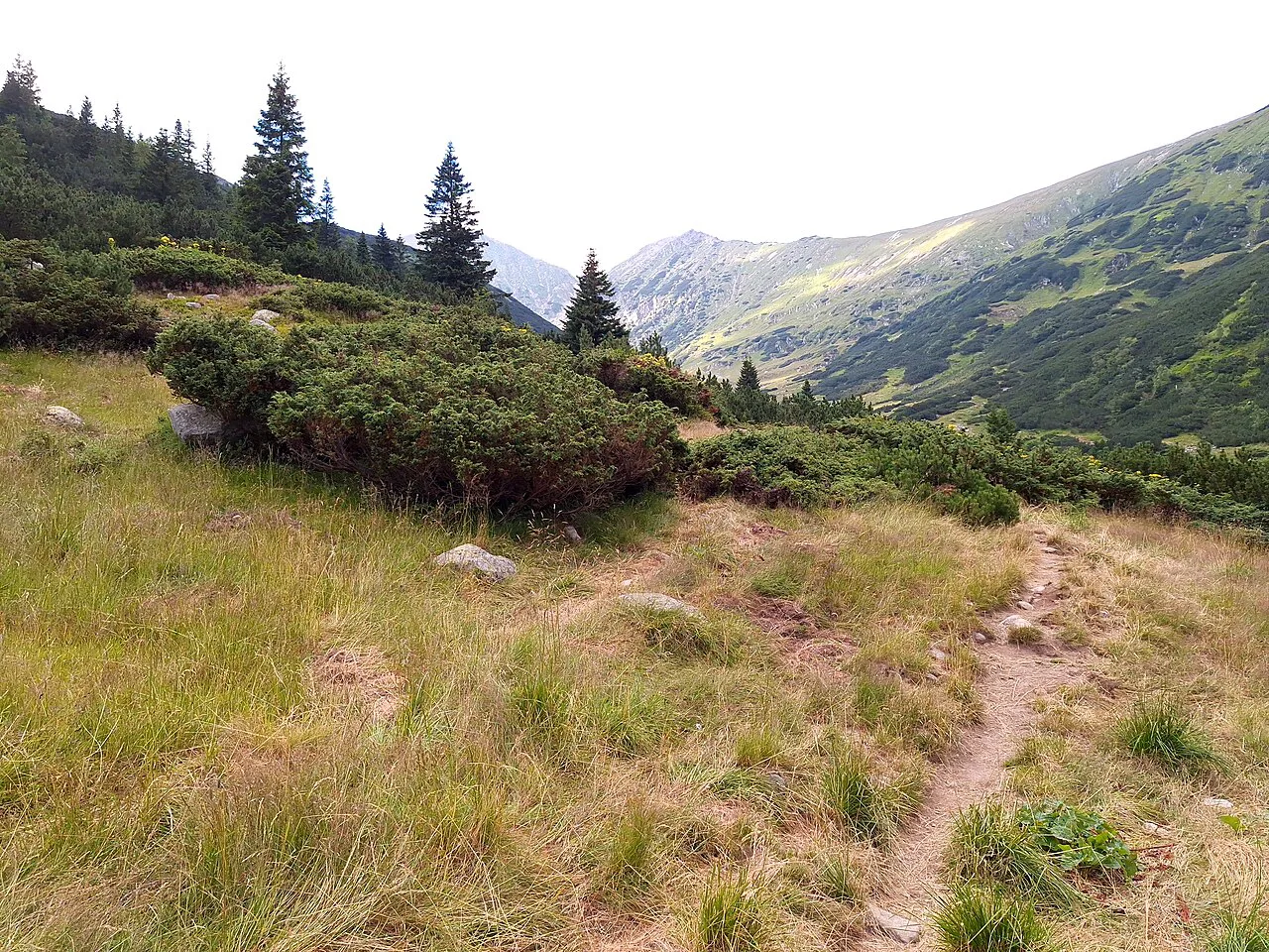
Retezat holds 55 mammal species, among them chamois, red and roe deer, wild boar, bear, wolf, fox and lynx, and otters live in the park's rivers. Birdlife includes around 120 nesting species, with golden eagle, eagle owl and three-toed woodpecker among the notable ones, and the park is part of the Important Bird Areas network.
Over a third of Romania's flora grows in these mountains, with alpine meadow species above the trees and beech, spruce and fir below. More than 1,100 butterfly species have been recorded, so a slow walk at meadow level is worth as much as a summit push.
The northern entrances: Carnic, Răușor and Gura Apei
On the north side, the park is entered from Carnic, Răușor and Gura Apei, all on the Hațeg side of the range. These are the entrances to use if you are coming from Corvin Castle, Deva or the denser road network around Hațeg.
A summertime minibus links Ohaba de sub Piatră, about 8 km south of Hațeg, with Carnic at the northern entrance. Treat that as a seasonal service to confirm locally before you build a day around it.
The southern entrances: Buta, Cheile Butii and Câmpu lui Neag
From the south, the park is reached at Buta, Cheile Butii and Câmpu lui Neag, the last of these sitting beyond Lupeni. This side suits travellers coming from Petroșani or the Jiului valley rather than from Hațeg.
Summertime minibuses run from Petroșani to Buta and Cheile Butii, and from Lupeni to Câmpu lui Neag. Outside that season, plan on your own transport to the trailhead villages.
Getting there by car
The main approach is national road DN66/E79 between Hațeg and Târgu Jiu. For the northern entrances, leave it at Sântămăria-Orlea and take county road 686D towards Răușor; for the southern side, continue to Petroșani and take DN66A through Vulcan towards Câmpu lui Neag.
These are ordinary county roads into working villages, so the last stretch is slow and you should arrive with a full tank and food rather than expecting services at the trailhead. If you are weighing Retezat against other upland areas, our round-up of mountains in Romania sets out the alternatives by region.
Getting there by bus and train
The nearest stations to the northern entrances are Ohaba de sub Piatră for local trains and Subcetate for express services; on the southern side they are Petroșani and Lupeni. Rail gets you to the edge of the area, not to the park itself, so the last leg is by minibus or car.
Sibiu, about 170 km north-east, and Timișoara, about 217 km west, are the nearest airports named for the park. From either you are looking at a car hire or a long combination of train and minibus, so most visitors drive.
Villages around the park
Sălașu de Sus, Râu de Mori and Câmpu lui Neag keep a traditional village way of life, and they are the practical places to base yourself at either end of the park. Staying in one of them shortens the drive and puts you in reach of the entrances before the day heats up.
Because the park is walked rather than driven, the villages around its edges are part of the visit rather than a staging post to hurry through. If you want to compare a lake-based day with other upland outings, see our guide to lakes in Romania.
Nearby sights worth adding
Corvin Castle at Hunedoara is about 56 km north of the park, Deva about 68 km north, and Densuș Church about 34 km north. Sarmizegetusa Regia, the Dacian capital in the Orăștie mountains, is roughly 82 km north-east, and Alba Iulia about 125 km north-east.
These pair naturally with a northern-entrance visit, since all sit on the Hațeg side where the roads are quicker. If you have already ticked off Retezat and want another park in the same range, Piatra Craiului National Park is the obvious next comparison.
What to sort out before you go
Sort transport to the trailhead villages first, because the summertime minibuses are the only public link and they do not run year-round. Decide which entrance you are using, book a base village near it, and check the return leg before you set out.
The park's own materials are the place to confirm entry arrangements, any fees and current rules, and to pick up a walking map for the area you have chosen. Do not plan a route from blog posts alone; conditions and access change.
Where to sleep near the park
Mountain chalets, guesthouses and campsites sit close to the park, with the villages named above the most practical bases. Book in the village at your chosen entrance rather than in Hațeg or Petroșani if you want an early start on the paths.
Which entrance should you use?
Pick the northern entrances at Carnic, Răușor or Gura Apei if you are combining Retezat with Corvin Castle, Deva or Densuș Church, and the southern entrances at Buta, Cheile Butii or Câmpu lui Neag if you are coming from Petroșani or Lupeni. Either way you need a car or a summertime minibus to reach the trailhead.
Base yourself in Sălașu de Sus, Râu de Mori or Câmpu lui Neag, confirm the latest entry arrangements with the park before travelling, and treat the lakes as a full day on foot rather than a quick stop.
Explore more Romania guides
Sources
Useful notes for your next trip
Optional updates to our guides.
You might also like

Continue reading
More guides you'll find useful